.jpg)
Geography of Isfahan
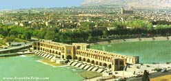
The province consists of 52 hydrological units belonging to 9 basins and 27 sub-basins. Rivers are small and temporary, with the exception of the Zayandarud, which totals 405 km in length, with an average annual discharge of 1,053 mcm, average annual precipitation of 450 mm, and a basin area of 27,100 km.2.
Isfahan Province is situated in central Persia between the massive central Zagros mountain range and the grand desert .
It covers an area of approximately 107,000 km2 between 30°42′ and 34°30′ N latitude and 49°36′ and 55°32′ E longitude (Sazman-e barnama,). It is bounded in the north by the Central Province (Ostan-e markazi) and the provinces of Qom and Semnan, in the south by the provinces of Fars and Kohgiluya o Boir Aḥmadi , in the east by Khorasan Province, in the southeast by Yazd Province, and in the west by the provinces of Luristan (Lorestan) and Cahar Mahal o Bakhtiari .
According to the national census, the population of Isfahan Province (ostān) was 4.9 million (compared to 1.5 million in 1956), comprised of 17 sub-provinces (Sahrestans), 60 towns in 37 districts (bakses), and 2,470 rural settlements in 116 sub-districts (dehestans). Up to and including the 1966 census, the province of Yazd was counted within the boundaries of Isfahan Province, and from the 1986 census, the sub-province of Kasan was annexed to Isfahan Province
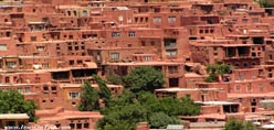
Isfahan Province consists of mountains and plains, with an average elevation of 1,600 m . The central Zagros mountain range forms the western borders of the province, including the following major mountains: Dalankuh (with a peak of 3,915 m), which extends from Faridan to Najafabad, Darrabid mountain (with a peak of 3,631 m) in Faridan, and Sahankuh (with a peak of 4,040 m) near Fereydunsahr, which runs in a southeasterly direction to Semirom and reaches the summit of Dena mountain in the province of Kohgiluya o Boir Aḥmadi. The Karkas mountains (with a peak of 3,895 m), an extension of the Central mountain range (selsela-ye kuhhā-ye markazi), extend from west of Kashan southeastward to Naein .The Karkas range divides the province into two distinct topographic and climatic areas: the more temperate western regions and the arid eastern regions.
The province consists of 52 hydrological units belonging to 9 basins and 27 sub-basins. Rivers are small and temporary, with the exception of the Zayandarud, which totals 405 km in length, with an average slope of 0.3 percent, average annual discharge of 1,053 mcm, average annual precipitation of 450 mm, and a basin area of 27,100 km2 .
Isfahan Province can be divided into three topographic and climatic regions based on their distance from the Zagros mountains in the west and the great desert in the east:
(1) Semi-humid and cold areas encompassing western and southern valleys, including the sub-provinces of Golpayagan, khansar, Faridan, Fereydunsahr, and Semirom.
(2) The arid areas along the edge of the central desert, including Naein, Ardestan, and Kashan, as well as the area of desert climate in the easternmost villages of Anarak, kur, and Jandaq.
(3) The semi-arid region of the oasis of Isfahan—with the Zayandarud as a main water resource—marked by a moderate climate and four distinct seasons, including the sub-provinces of Tiran and Karvan, Najafabad, Lenjan, Mobaraka, Falavarjan, komeynishahr (formerly Marbin), and Isfahan, as well as Sahreza along the road to Fārs and Borkhar o Meyma on the road to Qom and Tehran . The average annual rainfall in the meteorological stations varies from 6.7 cm in the easternmost villages of Ḵur and Biabanak to 147 cm in the Kuhrang station; relative humidity varies between 25 and 62 percent .
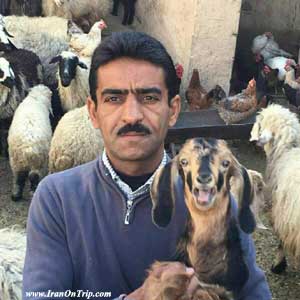
The province is generally poor in flora and fauna. The most typical of the plants are bushes and shrubs spreading over the steppes, but the landscape becomes richer with the increase in elevation. Characteristic trees are pine, cypress, plane tree, black poplar (kabuda), elm, and ash (Safaqi, pp. 128-35). Many of the highland forests are already extinct, as the trees have been burned for charcoal (see FORESTS). The western and southern highlands offer fine pastures. The fauna of the province used to be noticeably richer than it is today, with the existence of bears, leopards, boars , and zebras . Today, there are still some ibex , wild goats, and deer in protected zones (national parks), while the marshlands around the Gavkhuni lagoon attract hunters of wild birds. Other wild animals
such as foxes, jackals , wolves, and rabbits are still encountered in the plains.
The population growth in the province has been sustained by water diverted from the Karun river to the Zayandarud, the only major river of the province. During the last few decades, employment in agriculture has been increasingly replaced by industries and services. The industrial infrastructure of the province has expanded substantially, not only by the presence of heavy industries but also with the introduction of electricity and natural gas to most parts of the province; this has made it possible to establish industries in the undeveloped regions of the province, where industrial activities are encouraged by the government
.....
.....
.....